Friday, 14 September 2018

Zion Nat Park and Las Vegas


Zion National Park. Our final national park on this journey was Zion National Park. Zion is a little different from the other parks we’ve seen – you are down in the canyon rather than up above looking down. This different perspective makes all the difference. Zion is more greener, had more water streams and overall was quite beautiful. The rock formations were striking and tall and there were many hikes to choose from. A popular hike is up to the Narrows which is a narrow canyon with water flowing through it. People rented water proof boots and walked the river stream to the end. We didn’t do this as it was a long hike. However, it was nice to walk along the river to the popular viewing point. We also did a hike the following morning and it was a gorgeous view over the park. Before leaving, we drove the scenic drive to the East entrance and saw some fabulous rock formations like the Checkerboard Mesa – you’ll see this in the movie at the bottom. Zion was smaller than the previous parks but I think our favourites were Bryce and the Grand Canyon. Never the less, it’s well worth visiting and it’s certainly close to Vegas. This was the end of trip through magnificent Utah and this desert state has some of the best things you’d could imagine in a desert.

Las Vegas. And so we headed to the bright crazy lights of Las Vegas, Nevada which marks our 30.1 state in our 50 Shades of DC adventure. It was hot and windy when we arrived and we were not quite sure what to expect. Vegas has never been on our list but it's just one of things you have to do. We didn’t stay on ‘the strip’, instead opting for a nice hotel 10 minutes away from the madness. We headed downtown and were overwhelmed with the casinos and wierdos. This place is a party town. The road is fenced off on the sidewalk to both prevent drunks falling on the road but also to force you into shops and casinos. It was quite annoying after a while as it was taking ages to walk down the main strip. We likened it to the Gold Cost in many ways. We enjoyed a fabulous dinner at a French Steakhouse across from the Bellagio fountains. Unfortunately the fountains were not in action that night – it was too windy I think. Nightime brought out more weirdos but we headed home like a couple of oldies before the night got too late and crazy for us. 

We headed out early in the morning to see Hoover Dam where once again, that Colorado River was a central player. I’ve always wanted to see this engineering wonder and it was seriously impressive. Wiki says it’s a concrete arch-gravity dam on the Arizona-Nevada border. Constructed between 1931 and 1936 during the Great Depression, it resulted in a massive effort involving thousands of workers. It was initially called the Boulder Dam (area of Boulder) but was officially renamed to Hoover Dam for President Herbert Hoover by a joint resolution of Congress in 1947. We took a tour of the Plantroom which was 53 stories underground – I tried not to think of that as the elevator went down and down and down. We saw the huge power generators and pipes which take water from Lake Mead in which Hoover Dam impounds. Lake Mead is the largest reservoir in the US by volume when it’s full. The dam’s generators provide power for public and private utilities in Nevadad, Arizona and California.

We walked out across the dam wall and I bravely took a photo across the edge - it's 221m high. This wall is bloody high. I am always fascinated by such massive structures and even more so the ones that were built many years ago when technology was primitive. I had to smile that one of the innovations listed for this project was that workers were issued hardhats !! It is an engineering achievement and is today one of the great engineering wonders of the US and the world.

We enjoyed a relaxing afternoon at the hotel and headed to the Bellagio Hotel for their famous buffet. This was huge, overwhelming and very good value for money. I ate my share in prawns and crab legs but everything was lovely. The dessert selection was insane and we left fat and happy. As a final hurrah, we decided to try our luck very briefly inside the casino – Roulette is my game but the minimum game was $10 so this was definitely going to be a quick splurge. I felt embarrassed looking for the $2 table !! I only played for 15 minutes or so and ended up only $7 down which was a relief as I can only imagine how much damage people do here in these addictive gambling places. It was just insane, I have never seen so many casino’s in my life. So it was a tame night on the strip for us and hopefully we won't wake up to find a chicken or a tiger in our hotel room like a bunch of blokes did once !!

Anyway, this is the end of our long desert adventure and although we added only 2.1 states to our list (recall New Mexico was the .1 from the Four Corners), we’ve seen and done a bucket load of fabulous things that we will always remember. If you not seen the Grand Canyon or any of the National Parks in Utah, get moving.

Here’s a short collection of the photos of Zion and Vegas and of course, who else but Elvis to get your through the show.


Tuesday, 11 September 2018

Arches and Bryce Canyon


Our journey through America’s National Parks continued to Arches and Bryce Canyon. There are 59 National Parks in the US and we have only seen about 9 I think. Zion is next and will make 10. Each park we’ve visited is overwhelming and impressive. The US really know how to show off their natural wonders. Just incredible and as I scroll through the photos of each day I realise how incredibly lucky we are to have seen these places. 

NOW SHOWING.....I have made another short movie (at the bottom) to show the wonderful photos so please watch it to see what you have to put on your bucket list.

Arches National Park is in a town called Moab (we’re still in Utah). It reminded us of Boulder Colorado as it was an outdoor enthusiast town – bikes, hikers, ATVs, jeeps…anything that could be done outside. It was hot like it has been this whole desert trip but it’s quite dry so a little bit more bearable. It is the gateway to giant red rock formations in Arches and there is a history of dinosaur bones and prints. The town itself was full of hippy like people and simple had a cool atmosphere. We had some fantastic food and coffee here too which was a nice treat - we got great coffee at the Love Muffin (love this name). We headed out early to Delicate Arch - another one hour hike up, down and around the red rocks to reveal this huge natural arch feature. It was an interesting walk as we slogged it over a huge rock face that reminded me of Uluru at home and then walking the edges around cliffs to arrive at the beautiful arch. The photos speak for themselves (in the movie). We also checked out another site called Windows that were two holes in the rocks that could only be seen together at a particular point. These windows were huge holes, just mind blowing to stand under them. The park was filled with tall standing red rock features that your imagination could let you see any shape you wanted.

The afternoon was far more adventurous as we took an adrenaline pumping jeep adventure tour. Apparently Moab is the 4WD mecca of the world. This place was crawling with all kinds of all-terrain vehicles with big tyres, big suspension and big engines. There were trials bikes and mountain bikes too. Our driver was fantastic, funny guy and gave us an action packed ride for 3 hours. We didn’t see the traditional Arches sites but instead, burned around the local area called Hells Revenge – a bit unsettling at first but we learnt to hang on tight and felt quite safe with driver Ernie. I told him the only Ernie’s I knew were Ernie Dingo (famous Aust actor) and of course Bert and Ernie. He laughed saying he only knew Bert and Ernie. He loved having a group of Aussies as passengers and we gave him a good Aussie welcome. He showed us a spot where a dinosaur footprint was found but some idiot came out late one night, dug it out and took it home to use as a coffee table. He was eventually found out but said he threw it in the Colorado River – it was never found though. Idiot did jail time. What a shame – people can be so stupid.

After crawling up and down some steep and insane rocks, Ernie suddenly dropped the pedal and raced through the sand dune corners that at first caught us all off guard but we loved it. Ernie asked if that was fun and I said yeah mate, this is how Aussies drive to just get the milk !! He laughed and then every time he was going to do a speedy sand dune run, he’d say we’re going to get milk guys. Funny guy. We had a bloody blast and it really was the best three hours you could spend in Moab. For those coming to Moab, check these guys out at Outlaw Jeep Adventures here….Outlaw Jeep Adventures

Bryce Canyon National Park was our next destination headed down southeast. My wiki research says that….Bryce Canyon is actually not a canyon but a collection of giant natural amphitheatres. It is distinctive due to geological structures called 'hoodoos', formed by frost weathering and stream erosion of the river and lakebed sedimentary rocks. Bryce sits at a very high 8000-9000 feet (2400 – 2700m) and you will see in my movie, my Garmin watch showing the elevation and climbing we were doing on a hike. The Bryce Canyon area was settled by Mormon pioneers in the 1850s and there were some historical remnants of that time around the area.

We started the day with a horse ride along the canyon rim. It was a very slow ride but very relaxing to wander through the Dixie State Forest that borders the national park. We saw lots of pronghorn which look like deer or antelope. These are the fastest mammal in the southern hemisphere. Deb’s horse was Dandy, who farted constantly, I had Lady so you know who was the tramp in this duo and our friend JE had Wizzy. They were beautiful horses and were kind to us. Our guide was definitely a local young cowboy – bit of a drawl, spitter and chewer. Very friendly and gave us good tips to eat around the local area. We had a 90 minute ride and a great way to see a different part of Bryce area. 

Like the Grand Canyon, there was a free shuttle bus to ferry tourists around the park and stop at every lookout and hike trailhead. It’s an excellent way to get around, removes cars and congestion and lets you talk to other people and compare trail notes. We hiked down into the canyon which was so beautiful. The trails are good and vary from easy to hard. They are good trails and retain the natural beauty of the environment. We wandered around the tall hoodoos and canyon corridors and took a stack of photos. You will see several rock features in the movie – Queen Victoria, Thor’s Hammer and Wall Street. I reckon I saw a koala at one stage but no one else could – can’t help lack of imagination in some people. The climb back out of the canyon was challenging. We climbed down about 170m so I was counting every meter back up on my Garmin. It really was beautiful so there were lots of reasons to stop, take a breath and catch the view. There are plenty of hikes to do and I would love to come back to any of these national parks and spend a week exploring every corner of the park. At the end of the day we headed on a shorter hike near our cabin which rewarded us with a small waterfall. The water was very cold but it was nice to put my feet in it albeit for a minute or two.

Well that’s it for now, we’re off to Zion tomorrow before hitting the big lights of Vegas. Don’t forget to watch the movie. The music was inspired by our friend JE who was talking about seeing Keith Urban in concert. I said go for it and I thought one his songs was a good choice for this movie. Enjoy !!


Saturday, 8 September 2018

Antelope Canyon, Monument Valley

Horseshoe Bend. Next on our agenda was to head north towards Monument Valley. We stopped to view Horseshoe Bend, just outside of Page. This was quite a busy dirt carpark with people sprawling over the small hill along a sandy trail in the burning hot sun. It was hard to imagine something pretty was out here but yes, after a short 800m walk, there was this beautiful bend in the Colorado River. I’ll come back to that river in a minute. So Horseshoe Bend is literally a bend in the river that is quite pretty. The photos I’ve seen show stunning colours but ours were not as impressive. Regardless, it was good to see as everything on this trip is about the landscape.

Now, that Colorado River, it’s been following us everywhere. So I had to google it….it is one of the principal rivers of the southwestern US and north Mexico. It is 2330km (1450 mile) long and encompasses parts of seven US states and two Mexican states. 

It starts way up in the central Rocky Mountains of Colorado, flows generally southwest across Colorado, through the Grand Canyon before reaching Lake Mead on the Arizona-Nevada border where it turns south towards Mexico. So it flows through Colorado, Utah, Arizona, Nevada, California, New Mexico and Wyoming. I’m not sure how it gets to New Mexico and Wyoming – maybe smaller shoots of it go there. Anyway, it’s a big source of water and no doubt we’ll see more it along our journey.


Be sure to watch the short movie at the bottom to see the beauty of Lower Antelope Canyon and Monument Valley. But here's a short explanation of these beautiful sites.

Lower Antelope Canyon. After Horseshoe Bend, we had a short drive to see Antelope Canyon. We were all unsure what to expect aside from some gorgeous photos. Once again, Deb’s research paid off because Antelope Canyon was a hidden treasure that is increasing in popularity thanks to social media. A friend at work had also recommended it so many thanks to you Terri B – will send some lamingtons to you as a thank you. So it’s a slot canyon which is a narrow canyon formed by the wear of water rushing through rock. It is significantly deeper than it is wide. This was on Navajo land and we visited the Lower Antelope Canyon. There is also an Upper. It was formed by erosion of sandstone, primarilty due to flash flooding and also due to sub-aerial processes. Rainwater, especially in the monsoon season runs into the extensive basin above the slot canyone sections, picking up speed and sand as it rushes into the narrow passageways. Over time, the passageways eroded away, making the deep corridoors and smoothing hard edges in such a way to form characteristic flowing shapes in the rocks. (courtesy of wiki). Flooding in the canyon still occurs. A flood occurred on October 30, 2006, that lasted 36 hours, and caused the Tribal Park Authorities to close Lower Antelope Canyon for five months.

It was pretty busy here with small groups going through every half an hour. It was much cooler down underground (albeit it was open at the top through gaps). I was a little nervous about the steep steps down as I’m not great in confined spaces. But it was better when on the bottom and the colours were extraordinary. Like all the rock features we’ve seen, there were lots of shapes to be made from the rock formations. Check out the movie below to see if you can spot the lions head (like Scar from the Lion King), the lady with long hair blowing in the wind and there was one that is called the Rocky Mountains. There was a million ways to take a photo by taking the shot from any angle. It really was a beautiful experience and I would recommend visiting this underground canyon. One of the funny memories of this visit was watching some Asian ladies come out of the pit-drop toilets. Yes, they were quite foul and offensive but what pit-drop toilet isn’t. We watched two of the ladies come out and dry reach for 5 minutes. It was quite funny to watch and even their tour companions got a good giggle also.

Monument Valley.
We ended our trip in a small town called Kayenta. It was very small – like a one road place. But it did have a McDonalds and a Burger King. The Hampton Inn was lovely and the restaurant had wonderful food. We initially thought it would be Big Macs for dinner but not so as we enjoyed a lovely meal at this restaurant. We were only a small distance from the Arizona-Utah border and our phones were switching to Utah time which was an hour ahead. Made for a confusing day that’s for sure. Unfortunately, the hour difference made for a very early start the next morning for our sunrise tour on Monument Valley which was just across the border in Utah. We had to be up at 3.30am for a 6am tour (Utah time). It was half an hour drive away but it was totally worth it. I think it’s been one of the best things so far. Monument Valley is a cluster of vast sandstone buttes (hill with steep sides). The largest is about 300m above the valley floor. It is located on Navajo Nation Reservation and has been featured in many movies, especially the old Western cowboy movies and even Indiana Jones for the famous snake pit scene. This was another great tour pick by Deb after much research and while the early start was painful, the reward at the end was priceless. 

We had a brilliant tour guide named Don. A elder Navajo man who had been here for 30 years but was well educated and knowledgeable about the Navajo history and the valley. He is a retired Navajo Culture and Language Teacher. Our tour started in the dark and incredibly, we were joined by two other Aussies from Canberra – what’s the odds of that !! We crawled into a well used 4WD and we headed to a good sunrise spot. This was seriously a fabulous tour and Don was a big highlight.

Don was excellent. He was a quiet man, his sense of humour was great and he shared so much history on the Navajo people and also his personal family insights from his grandfather. He drews signs in the sand to show us how family and tribal movement was explained and talked to us about his trip to Syberia to learn of the connection to Navajo people. He totally made this tour fantastic and showed us some of best views of Monument Valley. I will not forget his demonstration in the sand to show us how one of the sand structures was formed. He made a little sandcastle, poured water on it, poked a hole in it and turned it on it's side. Far out, it was captivating and made it easy to understand what mother nature had done over thousands of years. Hopefully our photos have captured a little of this wonderful morning tour. It was well worth the very early start and again, I thoroughly recommend this tour and definitely ask for Don. Check out Navajo Spirit Tours here.....

Navajo Spirit Tours

Four Corners.
This is the point where four states intersect – Arizona, Utah, New Mexico and Colorado. Initially the corner was defined in 1861 only by North/South lines which was unusual. Wiki tells me that by defining one boundary as starting at the corner of another Congress ensured the eventual creation of four states meeting at a point, regardless of the inevitable errors of boundary surveying. The area was first surveyed by the U.S. Government in 1868 as part of an effort to make Colorado Territory into a state, the first of the Four Corners states formed. The first marker was placed at the spot in 1912. The first Navajo tribal government was established in 1923 to regulate an increasing number of oil exploration activities on Navajo land.

We have not ticked off New Mexico and while we literally put a foot in the state, I can only really in good conscience claim this as a 0.1. So, I declare our state tally as 29.1 in our 50 shades adventure.


X marks the corner spot


And finally, here's the short movie of the great pics of Antelope Canyon and Monument Valley. Enjoy the peaceful easy feeling.


Thursday, 6 September 2018

Grand Canyon South Rim

The mighty Grand Canyon. Holy big crack in the ground Batman. Wow – words are not enough. We spread ourselves over 2 days exploring the South Rim of the Grand Canyon. This place is just beyond words. I made a short slideshow at the bottom as the pictures say it better than words.

We arrived late afternoon to a very windy thunderstorm so our first view off the main lookout was about 2.5 seconds and freezing. The following morning we were up early to take a 45 minute helicopter flight with Maverick Helicopters. This was just spectacular and I totally recommend this. We’ve done 3 chopper rides now – Hawaii and Alaska and each place was gorgeous from the air. We had the helicopter to ourselves and the views were breathless. The canyon was just swallowing us. The colours, the erosion, the altitude and the long Colorado River…it was just overwhelming. The Grand Canyon sits around 6500 feet above sea level and the North Rim climbs up to around 9000 feet. We spent the afternoon exploring the South Rim which included a 4km walk along the canyon edge. There were some fantastic views and they run shuttle buses all over the park to ferry tourists around. It was super efficient and it was busy, but not overly given we are past the summer school holiday seasons.

We enjoyed a fabulous dinner that night at El Tovar which is inside the park and we were glad to hit the sack that night. Once again, Deb had me up early to go and see the sunrise. It was well worth it and there were many other keen and eager photographers there to capture this special time of day. Once again, Batman ventured out to the dawn to watch over the Grand Canyon.

On our day leaving, we stopped at the Desert View Watch Tower lookout to check out the view from this side of the canyon. There was an interesting landmark to mark the spot where two planes collided in 1956 above on the canyon mountains in front of us. They collided at 21000 feet as they were circling above to avoid storm clouds. 128 people died – very sad story. It was in such a desolated spot in the canyon so I have no idea how they got the wreckage. I’ll have to research that a bit further.

We headed North to Monument Valley where a crack of dawn tour awaits us tomorrow. For now, I leave you with a movie of our Grand Canyon views. The pictures speak volumes as words cannot say just how incredible this place is. Deb also reminded me of an episode from The Flintstones (under 30's will need to ask your parents). So funny really. 


Anyway, take a break and watch my short movie of the spectacular Grand Canyon. Enjoy !


Tuesday, 4 September 2018

Grand Canyon Road Trip

Our Grand Canyon Road trip will take us from Phoenix to Sedona, quickly out to Winslow to 'stand on the corner' and then up to Grand Canyon Village South Rim. We head up to Monument Valley and then up to Arches, coming back down through Bryce and Zion Canyon into Las Vegas. We have an exciting trip planned and look forward to the spectacular views of this wonderful land.
It was the beginning of our great Grand Canyon road trip with our good friends J&J. We have hired a big black Suburban car – this trip is like an extended episode of Criminal Minds only we’re not sure who’s going to be the ‘unsub’ and who’s gonna get left in the desert !! We’ve bought an esky, kettle, lots of water and supplies to make a cuppa and lunch along the way. We secured ourselves an impromptu mascot called ‘Princess’ during our wander through Walmart. She now features in many photos and rides in our backpack - and apparently my Batman appearances are embarrassing!  Our trip map is below and we are covering about 1200 miles (2000 km).


Phoenix. The capital of Arizona, in the middle of the desert. This is state number 29 for us. Far out, this place is HOT. It's flat, full of cacti and lots of mexican restaurants. Deb had planned a big hike on our first morning so we were on the trail by 6am just as the sun was breaking - the Cholla Trail up Camelback Mountain. We'd read lots of reviews and ascertained it was moderate to difficult, 3km long with steep sections towards the top. But the views would be worth it they said. Far out, it took us 2 slow hours to climb up and we were on our hands and knees for the last hour. It was a spider scramble and I have to admit, I was close to stopping as I could see plenty of nice views on the way up so the final crawl just didn’t seem to be worth it to me. There was a slight breeze but we were sweating and stopping lots to catch our breath.


Well the view at the top was gorgeous - a full 360 view of Phoenix. We were all so glad to get there - it was more about the challenge really. I've done some stupid things in my time and this is definitely one of them !! People were streaming up the trail - many under prepared with little or no water, no hat, bad shoes and just not in any shape to do the scramble. Unbelievable. The crawl down was a lot of sliding on bums and rock climbing slowly and the sun was out making us suffer even more. Pretty big start to the trip and we enjoyed a swim and breakfast back at the hotel. 


I was up early the next morning for a 10k run and it was about 28C at 6am. Bloody terrible. I struggled to finish as my legs were tired from the hike the day before and the heat killed what remained of my energy. We drove up to Sedona, still in Arizona where the flat desert become red rock desert with striking rock formations. Along the way we visited Montezuma Castle which was underwhelming. It was a rock face showing the outside of dwellings in the rock from around 1300AD but you can't go inside anymore. They had a diorama to show the inside but it was a quick visit as there wasn't much else to see. It was built and used by the Sinagua people, a pre-Columbian culture closely related to the Hohokam and other indigenous peoples of the southwestern US between approximately 1100 and 1425 AD. The main structure comprises five stories and twenty rooms, and was built over the course of three centuries.


About 20 minutes up the highway is the Montezuma Well. This is a natural limestone sinkholethrough which some 1,500,000 US gallons (5,700,000 litres) of water emerge each day from an underground spring. The Well measures 386 feet (118 m) in diameter from rim to rim and contains a near-constant volume of spring water even in times of severe drought. The water is highly carbonatedand contains high levels of arsenic. We enjoyed this more as it was interesting to walk around the area and read the information boards. Honestly, I was so busy watching the ground in front for rattlesnakes. And they reckon Australia is a dangerous place. 

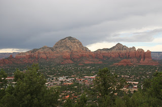
Sedona was a beautiful town, much more nicer than Phoenix. It has a very Mexican feel with buildings designed for the extreme heat. They look like they are made of clay but we think it’s cement render. They are that orange clay colour and low set. It is a very touristy town and surrounded by huge red rock mountains. There was Bell Rock, Cathedral Rock and lots of others. We arrived to a stormy afternoon which delivered only wind and no rain. We were planning to do a loop of the airport which provides beautiful views of the surrounding red rock mountains. But the weather was not great and we decided to drive up top. The view was lovely and I don’t think we lost anything by not hiking up. Deb had another hike planned the following morning so we were off around 6am. It was a much easier hike than Phoenix and cooler. It was around 3k and we got some nice views of Cathedral Rock. 


Winslow. We left Sedona and headed towards Winslow. Our only reason to go to Winslow was to ‘stand on the corner’. This being made famous by The Eagles in their Take It Easy song. I’ve been singing it for weeks….Standing on a corner in Winslow Arizona, and such a fine sight to see, there’s a girl my lord in a flatbed Ford slowing down to take a look at me….take it easy, take it easy. The Eagles music was playing in the corner store and there were several ol’ timers getting their photos taken. This is one of those moments for me, I just was thrilled to see this. They have the red Ford truck on the corner and two statues – one of Glenn Frey and one of Jackson Browne who co-wrote the song. Batman was seen on the corner too.


We ended the day at Tusayan which is just outside the Grand Canyon Village, South Rim area. We were here for 2 nights to explore the wonders of this big canyon. But until the next post, here's a few more shots from the trip so far.